 Southwest
Environmental LimitedSouthwest
Environmental Limited
Southwest
Environmental LimitedSouthwest
Environmental Limited| London |
| 02076 920 670 |
| Exeter |
| 01392 927 961 |
| Manchester |
| 01612 970 026 |
| Bristol |
| 01173 270 092 |
The below map shows various points along the River Thames London that have been modeled to produce future flood depths which take some allowance for climate change. The models are updated regularly and most the the below linked data is now out of date, but if you are an Architect or Planner looking to get an estimate of flood depths in a certain area Adjacent to the Thames, then it should suffice until you can order some new data.
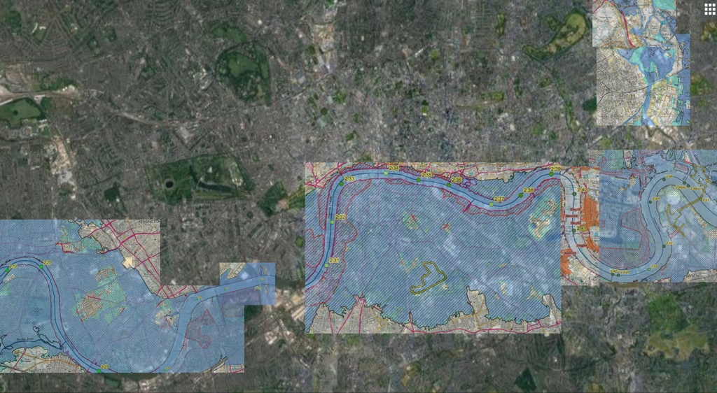
If you click on the below map, it will enlarge so you can read text. Maps on this map (OS content) reproduced under PMCL No LAN1001682.
