 Southwest
Environmental LimitedSouthwest
Environmental Limited
Southwest
Environmental LimitedSouthwest
Environmental Limited| London |
| 02076 920 670 |
| Exeter |
| 01392 927 961 |
| Manchester |
| 01612 970 026 |
| Bristol |
| 01173 270 092 |
An Ammonia Emissions Assessment is a report which looks in to the rates of ammonia exposure to sensitive receptors at certain distances from a proposed development, or an existing development. This can be an industrial installation, as waste processing facility but more often than not it is an intensive livestock development.
Do you require an Ammonia Emissions Assessment? Please contact SWEL for a quotation.
 An Ammonia Emissions Assessment is often
paired with an Odour Impacts
Assessment, in both cases Emission rates are calculated for the
proposed development. This can be done using secondary data, which is
often the case in planning. Or for an
Environmental Permit Application, this may include the collection of
real world monitoring data from a pre-existing site.
An Ammonia Emissions Assessment is often
paired with an Odour Impacts
Assessment, in both cases Emission rates are calculated for the
proposed development. This can be done using secondary data, which is
often the case in planning. Or for an
Environmental Permit Application, this may include the collection of
real world monitoring data from a pre-existing site.
This ammonia emssions data is then fed in to emissions modeling
software. We use AERMOD, which is a piece of software developed in the
USA and is valid alternative to the like of ASDM modelling which is also
popular amongst consultants.
The software takes in to account a wide varierty of variable such as the
temperatures of air, temperatures of exhaust, turbidity of atmosphere. .
. and most importantly wind direction. Typically a 1 year weather data
set is used. This gives a idea of ammonia concentrations at nearby
receptor locations, which might includes houses, or schools or both.
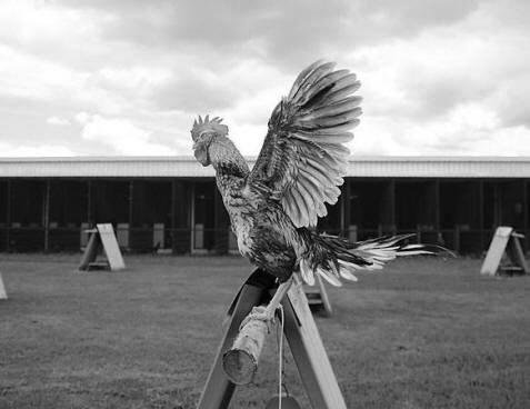
Image:
Piyarat Jun-On [CC BY 4.0], via Wikimedia Commons
Ammonia Emissions Assessment will include benchmarking of current levels of determinants and the developments likely impacts of these levels in relation to current local EQS.
Below guidance is listed on www.gov.uk.
You must submit a risk assessment of the impact of ammonia emissions from your site if either of the following apply:
Factors that could cause an increase of ammonia emissions include:
No not always, if you are running you your site as an installation, the Emissions for Ammonia may "Screen Out" as part of the H1 Assessment in which case detailed modeling as described above would not be required.
Please contact SWEL for a quotation.
The SCAIL tool (Simple Calculation of Atmospheric Impact Limits) is a suite of screening tools for assessing the impact from agricultural and combustion sources on semi-natural areas like SSSIs and SACs. SCAIL is now available as two models
Both models provide an estimate of the amount of acidity, nitrogen or sulphur deposited on to a habitat or sensitive ecosystem. Output from the models can then be used to assess whether impact limits for the habitat are exceeded or not. The models are useful as an initial screening of sources for IED applications or Appropriate Assessments under the Habitats Directive.
As with our computer modeling SCAIL uses AERMOD to model impacts. With SCAIL the inputs are generalised and pre-determined and although they make a good job for screening out a site quickly, they over estimate impacts significantly. Our more complex model can add extra detail, such as variable emission rates that will more accurately reflect you actual activity.
SWEL can undertake this assessment on you behalf, as we have considerable experience. It is not overly difficult to do, but in some cases one must choose inaccurate descriptions (best fit) and some find this a little unnerving.
A particularly time consuming new requirement for Ammonia Assessments. Is the In Combination Assessment. This involves looking through lots of planning application within 10km of the application site, and trying to add up all of the process contributions. This is an utterly joyless exercise, and really cant pay us enough to do it for you. We would rather be working down a coal mine.
On the below map, you will find planning applications that are in some way related to ammonia. If you would like to add you own, please contact us, and we will grant access so you can edit the map.
Converting that table into a bulleted list is a great move for scannability. This format is also very "AI-friendly" because search models can easily parse these as distinct facts.
Here is your list of 20 ammonia-sensitive sites and their habitat triggers:
Somerset Levels & Moors SSSI - Lowland Wet Grassland - RAMSAR species & Nitrogen sensitive flora
Wistman's Wood SSSI (Devon) - Upland Oakwood - Rare Epiphytic Lichens & Bryophytes
Westhay Moor SSSI - Lowland Raised Bog - Sphagnum mosses (Highly sensitive to NH3)
Thursley, Hankley & Frensham SSSI - Lowland Heathland - Rare mosses and specialized heath flora
Epping Forest SSSI / SAC - Beech Woodland - Ancient trees and sensitive fungal networks
Fenn's, Whixall & Bettisfield SSSI - Raised Bog - Active bog forming vegetation
Windsor Forest & Great Park SSSI - Wood Pasture - Rare lichens on ancient bark
Peak District Moors SSSI / SAC - Blanket Bog - Peat-forming mosses
Dorset Heaths SSSI / SAC - Lowland Heath - Nitrogen-sensitive dwarf shrubs
Sherwood Forest SSSI - Acidic Woodland - Ancient oak and associated lichen communities
New Forest SSSI / SAC - Valley Mires - Sensitive wetland bryophyte species
Ingleborough SSSI - Limestone Grassland - Rare arctic-alpine flora
Breckland SSSI / SAC - Inland Dunes / Heath - Rare lichens and specialized sand flora
Exmoor Heaths SSSI - Upland Heath - Blanket mire and sensitive mosses
Thursley Common SSSI - Mire / Bog - Sphagnum and invertebrate-supporting moss
Wyre Forest SSSI - Oak/Birch Woodland - Sensitive ground flora and lichens
Derwent Gorges SSSI - Ash/Oak Woodland - Rare bryophyte assemblages
Hatfield Moors SSSI - Lowland Raised Bog - Nitrogen-vulnerable peatland species
Cannock Chase SSSI - Lowland Heath - Dry heath and sensitive berry-bearing plants
Salisbury Plain SSSI - Calcareous Grassland - High-biodiversity orchid and grass species