 Southwest
Environmental LimitedSouthwest
Environmental Limited
Southwest
Environmental LimitedSouthwest
Environmental Limited| London |
| 02076 920 670 |
| Exeter |
| 01392 927 961 |
| Manchester |
| 01612 970 026 |
| Bristol |
| 01173 270 092 |
It used to be the case that when ordering flood data from the Environment Agency you would pay £60 for the privilege. A few years ago the EA started supplying it for free (never understood why) and now in some areas of London they are saying that they can only provide the raw data, because they can't afford the staffs time to create site specific reports. . . . .
 This
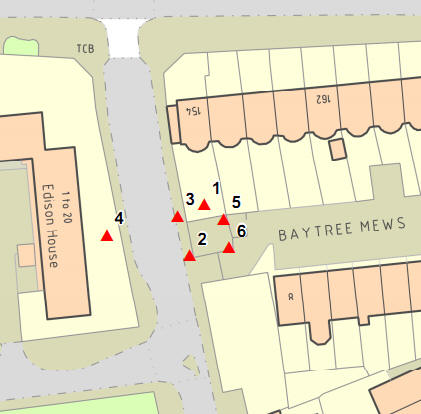
leaves us in a bit quandary, as we rely on rely on maps (PMCL No LAN1001682)
such as the one to the left for writing our reports.
This
leaves us in a bit quandary, as we rely on rely on maps (PMCL No LAN1001682)
such as the one to the left for writing our reports.
Instead we are now given a 300MB zip files containing GIS flood depth information for large areas of London. Which can be downloaded from here: GIS Flood Data for London
The reasons for this change of delivery was explained thusly:
Your request for a P4 and 8 falls under the exemption in provision 6(1)(a) and
(b) of the Environmental Information Regulations 2004 (EIR) which states that
‘……6.—(1) Where
an applicant requests that the information be made available in a particular
form or format, a public authority shall make it so available, unless—
(a) it is reasonable for it to make the information available in another form or
format; or
(b) the information is already publicly available and easily accessible to the
applicant in another form or format………………’
On this occasion we are not providing the information in the Product 4 and 8
format, for the following reasons:
·
Complying with the preference would incur a significant cost, which the public
authority [The Environment Agency] cannot pass on to the requester;
·
Using a Product 5/6/7 allows us to make the information available at a lower
cost; and
·
The impact on the available resources of the public authority [The Environment
Agency], of supplying a Product 5/6/7, is therefore much less.
 The
image to the right shows the data coverage area, this being issued by the KSL
team, which cover the eastern "half" of London. The HNL team cover most of the
rest of London. So if you reuire flood depths for sites in:
The
image to the right shows the data coverage area, this being issued by the KSL
team, which cover the eastern "half" of London. The HNL team cover most of the
rest of London. So if you reuire flood depths for sites in:
Then you will likely have to interrogate the supplied GIS information and retrieve flood depths.
If you would like us to do this for you then we can. Please contact us, and we provide a written quotation.
The below section was written by a machine.
Flood Depth GIS mapping is a sophisticated tool used to visualize and quantify the physical impact of a flood event on a specific site. Unlike standard hazard maps that only indicate presence or absence of risk, GIS analysis provides precise depth estimates across a development's footprint, which is essential for sophisticated Flood Risk Assessments (FRA).
Using high-resolution Digital Elevation Models (DEM) and LIDAR data, our GIS consultants can overlay predicted water levels to produce detailed depth grids. This technical evidence is vital for:
GIS data does not exist in a vacuum; it is the foundation for much of our broader consultancy work. By accurately mapping depth, we can better understand the interaction between water and other environmental constraints.
Southwest Environmental Limited provides the technical authority required to deliver complex geospatial analysis for projects across the UK. With over 900 projects delivered, our evidence-based approach is trusted by developers and regulators alike. Our consultants hold the professional credentials (IES, IAQM) needed to ensure your GIS outputs satisfy both the Environment Agency and Lead Local Flood Authorities. Whether you are adjusting for climate change allowances or seeking pre-application advice, our GIS mapping provides the clarity required for success.