Flood Risk Assessment – Merton
SWEl have recently prepared a Flood Risk Assessment for an interesting proposed development in Merton (New Maldon).
The development sees the retention of a existing building for conversion under PD rights, and the creation of e neighbouring residential unit.
Below images show various mapping used in the compilation of the report.
 |
| Flood Extent Mapping in Merton |
Modelled flood data was obtained and used in describing the site as low risk.
 |
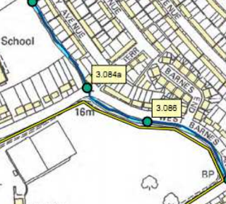
| Model Nodes used in 2D Models |
Both 1D and 2D flood modelling data was used, the nearest water course was the Beverly Brook.
 |
| A Considerate Design improves Planning Success |
The Flood Risk Assessment also considers surface water run-off, thankfully the development was considerately designed with large areas of soft landscaping.