Category Archives: Ecology

Great Crested Newt District Level Licensing – South Gloucestershire

Great Crested Newt District Level Licensing – South Gloucestershire

Building your own home is an exciting milestone, but the planning process can sometimes unearth unexpected challenges, especially when local wildlife is involved. We recently had the pleasure of supporting a client with their application to erect a single self-build dwelling. The project, beautifully situated in the South West, is a perfect example of how early ecological consultation can keep your development on track.

The Challenge: Nearby Habitats

When embarking on a new build, assessing the surrounding environment is a critical first step. While there were no waterbodies directly within our client’s site boundary , our assessments identified three ponds within a 250-metre radius. Because the Great Crested Newt (GCN) is a European protected species , strict regulations apply to developments that could disturb them or damage their resting places. Even if the newts aren’t directly on your footprint, nearby ponds often mean you need an official strategy to proceed.

Great Crested Newt – Rainer Theuer

The Solution: District Level Licensing (DLL)

To ensure the project could move forward without delays, we acted as the lead ecological consultants to manage the Great Crested Newt District Level Licensing (DLL) process. District Level Licensing is a fantastic route operated by Natural England that often provides a quicker, more streamlined alternative to traditional mitigation licenses. Here is how we delivered for our client:

First, we managed the necessary ecological assessments, including eDNA surveys to accurately determine the presence or absence of GCNs in the area. Second, we handled the complex DLL enquiry process from start to finish, meticulously compiling site data and mapping the required GIS polygon shapefiles. Finally, by acting as the primary agent, we ensured all documentation was fully complete and accurate, aligning the proposed construction timescales with the licensing requirements.

Keeping Your Project Moving

Because we handled the technical intricacies of the wildlife legislation, our client was able to submit their planning consent with the confidence that the licensing requirements were fully under control.

Do you need help with a GCN DLL Enquiry?

Whether you are planning a small private development or a large-scale project, navigating protected species legislation doesn’t have to be a roadblock. Our team of expert ecologists is here to guide you through the District Level Licensing process quickly and efficiently. Contact us today to discuss your site and find out how we can help you achieve your development goals while supporting local biodiversity.

District Level Licensing for Newts 

Ecological Drone Survey Services: Applications of RGB Photogrammetry

Drone Surveys for Ecological Purposes

Through the application of photogrammetry and post-processing software, this standard imagery can be converted into measurable, actionable data for ecological assessment.

Below is an overview of the ecological drone survey services we offer, utilizing RGB cameras and advanced data interpretation techniques.

Drone Data Collection Planning

Habitat Mapping and Land Cover Classification Surveys

Our habitat mapping surveys generate high-resolution orthomosaics—distortion-free maps created by stitching together overlapping aerial photographs. These outputs provide a precise top-down view of the survey area.

  • Micro-Habitat Delineation: We map distinct vegetation zones, wetland boundaries, and transition areas (ecotones) at a centimeter-level resolution, providing greater detail than standard satellite imagery.

  • Invasive Species Identification: High-resolution RGB imagery allows for the visual identification and mapping of specific invasive plant species based on their distinct coloration or flowering periods.

  • Habitat Fragmentation Analysis: The data allows for the measurement of distances between habitat patches, the length of edge habitats, and the assessment of wildlife corridor connectivity.

3D Topographical and Structural Surveys

Using Structure from Motion (SfM) software, we process 2D images to construct accurate 3D models of the ecosystem, allowing for the analysis of physical vegetation structure and ground topography.

  • Canopy Height Models (CHM): By generating a Digital Surface Model (DSM, representing the top of the vegetation canopy) and a Digital Terrain Model (DTM, representing the bare ground), we can calculate the specific height of forest or scrub canopies.

  • Biomass and Carbon Estimation: Structural metrics derived from our 3D models can be correlated with ground-truthed data to support the estimation of above-ground biomass and carbon storage.

  • Hydrology and Geomorphology Mapping: DTMs allow for the modeling of surface water flow, the identification of pooling areas in wetland ecosystems, and the measurement of coastal or riverbank erosion over time.

Vegetation Health Assessments (RGB Indices)

While Near-Infrared sensors are standard for certain health metrics, vegetation vigor can still be estimated using purely RGB data through mathematical manipulation of the red, green, and blue pixels.

RGB Data Interpretation

  • Visible Atmospherically Resistant Index (VARI): We utilize VARI to assess canopy cover and relative plant health. This index measures the greenness of an area while minimizing atmospheric effects.

  • Phenology Monitoring: Through repeated surveys, we can map seasonal changes such as spring leaf-out or autumn senescence, providing data on phenological shifts and climatic impacts on local vegetation.

Wildlife Population Surveys

Standard RGB drone imagery is an effective method for direct population counts, particularly in areas that are difficult to access on foot.

  • Colony Counting: We conduct high-altitude orthomosaic surveys to capture nesting bird colonies or resting marine mammal populations. This method minimizes the disturbance associated with ground surveys or low-flying crewed aircraft.

  • Automated Detection: Orthomosaic outputs can be integrated with AI and Machine Learning models to facilitate the automated detection and counting of specific animal species across large survey areas.

Habitat Condition Survey

Temporal Change Detection and Monitoring

We offer repeatable survey programs to monitor changes in a specific landscape over time.

  • Restoration Monitoring: For sites undergoing rewilding, peatland restoration, or afforestation, we conduct automated grid flights at regular intervals (e.g., bi-annually). By analyzing the resulting orthomosaics and 3D models chronologically, we provide quantifiable data on landscape recovery and structural changes.

Shadow Habitats Regulations Assessment (SHRA) for Salisbury Developments

Understanding the Shadow Habitats Regulations Assessment (SHRA) for Salisbury Developments

When planning a residential conversion in an urban center like Salisbury, developers must navigate a complex landscape of environmental law. A critical component of this process is the Shadow Habitats Regulations Assessment (SHRA).

Recently, a project involving the conversion of commercial space into 44 apartments in the heart of the city underwent this rigorous evaluation to ensure the protection of the River Avon Special Area for Conservation (SAC).

What is a Shadow Habitats Regulations Assessment (SHRA)?

An SHRA is a technical report prepared by environmental consultants to assist the Competent Authority (in this case, Wiltshire Council) in fulfilling their legal obligations under the Habitats Regulations 2017.

Because the River Avon is highly sensitive to nutrient loading, any project that increases wastewater must prove it will not adversely affect the “integrity” of the protected site.

Atlantic Salmon

The Nutrient Neutrality Challenge in Wiltshire

The primary hurdle for Salisbury developments is Phosphorus (TP). Excessive phosphorus leads to eutrophication—a process that depletes oxygen in the water and threatens qualifying species such as:

  • Atlantic Salmon (Salmo salar)

  • Bullhead (Cottus gobio)

  • Desmoulin’s Whorl Snail

For this specific city-center conversion, the initial Phosphorus Budget identified a potential loading of 4.03kg/year (including a 20% precautionary buffer).

Achieving Stage 2: Appropriate Assessment

Under Stage 1 (Screening), it was determined that a “Likely Significant Effect” could not be ruled out due to the site’s hydrological connectivity to the River Avon. This triggered a Stage 2: Appropriate Assessment.

To mitigate the impact, the project adopted two key strategies:

  1. Water Efficiency: Restricting consumption to 85 litres per person/day to minimize wastewater volume.

  2. Phosphorus Credits: The remaining 3.2kg/year budget is offset via a credit scheme managed by Wiltshire Council.

Key Takeaways for Developers

  • Nutrient Neutrality is Mandatory: If your project is within the River Avon catchment, you must demonstrate a net-zero nutrient impact.

  • The Role of Mitigation: Following the People Over Wind case law, mitigation (like purchasing credits) cannot be considered at the Screening stage; it must be addressed within the Appropriate Assessment.

  • Strategic Planning: Securing phosphorus credits as a pre-commencement condition is often the only viable path for high-density urban conversions in Salisbury.

By utilizing a professional Shadow Habitats Regulations Assessment, developers can provide the necessary scientific evidence to Natural England and the local planning authority, ensuring that city growth and river conservation go hand-in-hand.

The New 0.2 ha BNG Exemption

Big Changes for Small Sites: The New 0.2 ha BNG Exemption

This 0.2ha rules will come in to force sometime in the first half of 2026.

New Biodiversity Net Gain (BNG) Exemption for Small Sites

The UK government has announced a significant shift in Biodiversity Net Gain (BNG) requirements to support small-scale developers. As of December 2025, the housing minister confirmed that developments on sites smaller than 0.2 hectares will be exempt from the mandatory 10% BNG requirement.

What is Changing? Previously, even small sites were required to demonstrate a 10% increase in biodiversity, often using the Small Sites Metric (SSM). Under the new policy, sites with a total area under 0.2 hectares will no longer be required to meet this statutory 10% uplift. This threshold was selected as a compromise after earlier proposals suggested exempting sites up to 0.5 hectares.

Red Line or Built Area?

Measurement and Site Area The 0.2-hectare threshold is based on the entire site area as defined by the red line boundary of the development. It is not limited to the built area or the developed footprint. This means that if the total area within your red line boundary is 0.2 hectares or more, the exemption will not apply, even if your actual building footprint is very small.

Which Metric Do I Use?

Metric Calculators for Larger Sites For sites that exceed the 0.2-hectare threshold but are still classified as small sites (typically up to 9 dwellings or less than 1 hectare for residential), the Small Sites Metric (SSM) remains the primary tool. However, if a site is over 0.2 hectares and contains “priority habitats” (such as ancient woodland or specific grasslands), the more complex Statutory Biodiversity Metric must be used instead.

Why the Change? The primary goal is to reduce the administrative and financial burden on SME housebuilders. For micro-sites, the cost of ecological surveys and the requirement to secure 30-year management plans were often seen as disproportionate to the environmental impact. By removing these hurdles, the government aims to accelerate the delivery of infill housing and urban development.

Current Status and Parliament Timeline The government’s formal response to the BNG consultation and the full implementation timeline are expected in early 2026. Because this change requires secondary legislation to become law, it must be laid before Parliament as a Statutory Instrument. While a specific day has not yet been set, the legislative process is expected to move forward in the first half of 2026. Until this legislation is officially enacted and brought into force, the existing BNG rules—including the 10% mandate for small sites—remain the legal requirement.

Additional Consultations Alongside the 0.2-hectare rule, the government is consulting in early 2026 on a further exemption for residential brownfield sites up to 2.5 hectares. This is intended to incentivize development on previously used land with low ecological value.

If you need help with anything Ecological including BNG please Contact Us

The Hidden Risks: Why BNG Baseline Surveys Demand a Professional Ecologist 

The Hidden Risks: Why BNG Baseline Surveys Demand a Professional Ecologist

I am not very risk averse. I don’t wear a helmet when I go skiing. I eat a lot of saturated fats, and when I am undertaking projects for hobbies (building extensions / forestry etc) then I don’t follow many safety precautions. My instinct of self preservation is set fairly low. . . . . .

BUT. One topic I am very careful with is Ecology. Because I don’t want to go to jail. . . . and please don’t think I am over-egging this 2 guys got sent to jail for chopping a tree down last year.

With mandatory Biodiversity Net Gain (BNG) now a core part of the planning process in England, the temptation for developers and landowners of smaller sites to fill out the baseline assessment themselves is understandable. After all, the Small Sites Metric (SSM) is marketed as being usable by a “competent person.”

However, to rely solely on a layperson’s judgment for the BNG baseline survey is to expose the entire project to significant risks—legal, financial, and planning—that far outweigh any initial cost savings. The BNG metric is a legal tool designed by ecologists, but only an expert can navigate the fine line between satisfying a planning condition and avoiding a criminal offence.

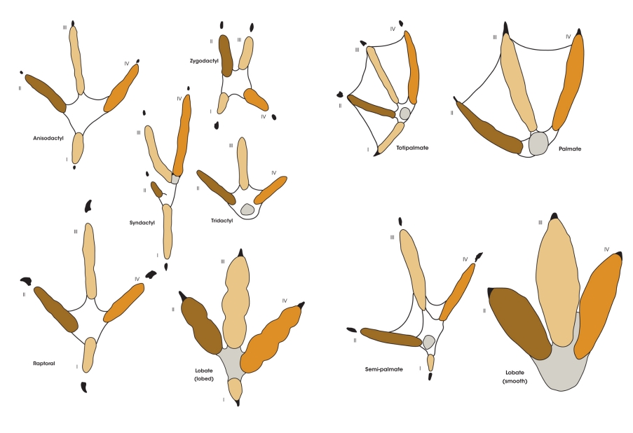
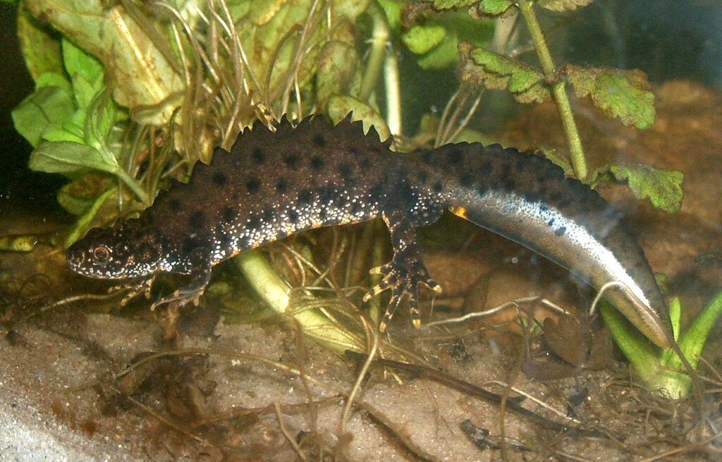
Tracks and Signs of the Birds of Britain and Europe (Bloomsbury Naturalist) – An Excellent Book for Species Identification

The above is just ones of the 100’s of figures contained within “Tracks and Signs of the Birds of Britain and Europe” it takes years of experience to be able to read these signs. I wouldn’t know which of the above are protected and which are not. That is why I would recommend getting an ecologist to do you BNG baseline survey.

1. The Critical Flaw: The Habitat Condition Trap

The BNG Metric, whether the full Statutory Metric or the simplified SSM, relies on accurately defining the type and condition of every habitat on site. This is where a layperson is most likely to fail the Local Planning Authority (LPA) check.

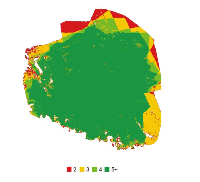
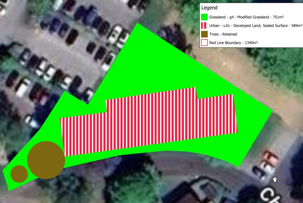
An ecologist is trained in the UK Habitat (UKHab) Classification system and uses standardised criteria to score habitat condition. For example, what looks like “long grass” to a layperson might be identified by an ecologist as Low-Quality Modified Grassland (low biodiversity value), or, critically, as Priority Habitat Lowland Meadow (high biodiversity value). Misclassifying a high-value habitat as a low-value one:

Massively underestimates the baseline biodiversity unit score.

Requires far more compensatory habitat creation (often making the development unviable).

Guarantees that the LPA will reject the submission, leading to months of expensive delays while a professional survey is commissioned and the metric is re-run.

2. The Legal Threat: Protected Species Liability

The BNG Metric and Protected Species Law operate on separate tracks, but they meet on the ground—your development site. The greatest risk is criminal prosecution under wildlife legislation.

Protected species (such as bats, badgers, and great crested newts) and their habitats are protected by law, primarily the Wildlife and Countryside Act 1981 and the Conservation of Habitats and Species Regulations 2017. Disturbing or destroying their resting places is a criminal offence, even if it is done accidentally.

A layperson’s baseline survey only focuses on the habitat units and cannot definitively rule out protected species. For instance, an old shed or a mature tree hole may be a bat roost. A pond may hold a population of Great Crested Newts. An ecologist, through a Preliminary Ecological Appraisal (PEA), specifically flags these features and identifies the need for mandatory, species-specific surveys. A layperson who fails to spot these signs and proceeds with demolition is committing a crime.

Recent Criminal Sentences

The risk is not theoretical. Criminal sentences for wildlife offences associated with development are becoming increasingly severe:

  • Financial Penalties: Fines for companies and individuals can be unlimited for offences relating to Protected Species.
  • Custodial Sentences: Individuals found guilty of intentional or reckless damage can face imprisonment. For instance, prosecutions have resulted in significant fines for developers found guilty of destroying badger setts or disturbing bat roosts, often running into the tens of thousands of pounds, alongside orders to pay massive remedial costs and prosecution costs.
  • Somerset Example: A recent case in Somerset saw a caravan park owner ordered to pay over £116,000 for disturbing a Site of Special Scientific Interest (SSSI), demonstrating the courts’ willingness to issue punitive financial orders under the Proceeds of Crime Act where clear environmental harm and disregard for the law are found.

In conclusion, while the SSM is designed to be accessible, a layperson completing the BNG baseline is making critical ecological judgments that carry profound legal and financial weight.

An approved BNG plan is not a “get out of jail free” card for protected species law. Engaging a qualified ecologist is the only way to ensure the data is accurate, the project avoids criminal risk, and the planning process is delivered efficiently. Don’t risk a development delay or a criminal prosecution to save on an essential ecological report.

BNG Assessments London

London BNG Expertise: Over 20 Assessments in the Last Year

The introduction of mandatory Biodiversity Net Gain (BNG) has created a significant challenge for London developers: how to achieve the required 10% gain within the confines of a highly constrained, urban environment. At SWEL, we have rapidly mobilised our ecological expertise to meet this demand, completing over 20 BNG assessments across various London boroughs in the last year alone.

Top Tip: Please don’t do any site clearance works before you have spoken to our ecologists. It could cost you a great deal of money if chop down a valuable tree (£25,000 per tree).

This hands-on experience has equipped us with the proven strategies needed to navigate the complexities unique to the capital. While many developments have zero or low ecological baselines, the London Plan demands meaningful contributions to green infrastructure. Our track record shows we successfully apply the statutory Defra Metric to urban sites, identifying creative solutions such as:

  • Urban Greening Factor (UGF) Integration: Ensuring BNG designs complement and achieve the borough’s Urban Greening Factor targets.
  • Green Roofs and Walls: Maximising ‘high distinctiveness’ habitats in limited space.
  • Off-site Unit Planning: Securing and allocating registered off-site BNG units where on-site delivery is not physically possible.

Example Plans Created by SWEL’s Ecologist

Rapid Response: Qualified Ecologists Ready for Your Project

We understand that delays in planning can be costly. The challenge faced by many Local Planning Authorities (LPAs)—which often lack the in-house ecological expertise and are reporting staff shortages—can slow down the BNG verification process.

To directly address this speed bottleneck, SWEL has a dedicated team of suitably qualified proactive and personable ecologists standing ready to deliver your assessment on a rapid turnaround. Our experts are proficient in the latest statutory metric and the nuanced requirements of individual London Boroughs. By submitting a robust, accurate BNG Assessment and Habitat Management Plan (HMP) from day one, we help your application move through the system efficiently, avoiding unnecessary requests for further information and reducing your time to consent.

On-Site Mitigation?

Our service goes beyond simply calculating your Biodiversity Net Gain (BNG) deficit; we provide comprehensive strategies for achieving the mandatory 10% net gain, regardless of your site’s complexity. We offer expert advice on both on-site mitigation—designing and integrating ecologically valuable habitats such as green roofs, sustainable drainage features (SuDS), and enhanced landscaping directly into your development plans—and securing off-site BNG credits. Whether your London site is too constrained for on-site delivery, or you need a rapid solution, we guide you through the process of legally purchasing and allocating credits from registered off-site providers, ensuring your project achieves the necessary net gain quickly and compliantly for local authority approval.

Another Example Plan From a BNG Assessment

In conclusion, partnering with Southwest Environmental for your London Biodiversity Net Gain assessment delivers both unrivalled expertise and critical efficiency. Our proven track record of successfully navigating over ten complex BNG assessments in urban settings over the past year, combined with our strategic advice on both on-site design and off-site credits, ensures a compliant and pragmatic path to planning consent. When time is money and regulatory detail is paramount, trust SWEL’s team of qualified ecologists to provide the rapid, robust, and reliable BNG solutions you need to keep your London development on schedule and ethically sound. Contact us today to secure your swift BNG assessment.

Do I Really Need An NNMAS?

Do I Really Need An NNMAS?

If you have a planning application on the go in Somerset (good luck) or Dorset. Then you may have been asked for an NNAMS (Somerset) or NNMAS (Dorset).

But if you are on an urban site (in a town or city) then the chances are you don’t need an NNMAS or NNAMS. . . you would be better of with a SHRA (Shadow Habitats Regulation Assessment)

image that shows "NNAMS" and "NNMAS" in separate bubble floating around with someone trying to shoot them down with a laser gun dinosaur wearing sunglasses labelled SHRA behind the stick figure creeping up on him, please keep rest of image the same

NNMAS or NNAMS – – -snap: SHRA

NNAMS or NNMAS. . . . It’s just a name.

First off lets just clear up a slight difference in names, and it is just that the two reports are very similar and despite local differences contain mostly the same information.

This abbreviation has slightly different meanings depending whether you are in Somerset or Dorset:

  • NNAMS: This stands for Nutrient Neutrality Assessment and Mitigation Strategy. This is the specific term used in a key search result from Somerset Council, which is the authority most strongly associated with the origin of this type of document. The council’s guidance refers to this exact phrase and abbreviation.
  • NNMAS: This stands for Nutrient Neutrality and Mitigation Statement. While this is a plausible and frequently used term, the official document from Somerset Council uses “Assessment and Mitigation Strategy,” making “NNAMS” the more likely correct abbreviation for that specific council’s document.

Why You Might Not Need The NNAMS or NNMAS

There are certain situations where you might not need an NNAMS or NNMAS.

You Don’t need a NNAMS or NNMAS

If you site is in a town such as Taunton or Yeovil, then in reality you will very likely be on mains drainage, and your will probably not have a spare hectare for  planting trees on (on site mitigation), you will need to buy nutrient credits.

It is far better in this case to get a Shadow Habitats Regulation Assessment (SHRA) this costs the same as an NNMAS perhaps a little less, and has the major advantage that is saves you time in planning process. Explanation:

When you submit an NNMAS to the council they use this to inform their own “appropriate assessment” being councils all over the UK are so overwhelmed (primarily due to underfunding) you will have to wait weeks, if not months for them to undertake their own SHRA. So why not do it for them. They would need the NNMAS anyway. . .

You Do need a NNAMS or NNMAS

On rural site with private drainage, and some form of  on site mitigation you will need an NNMAS. This is because the the structure of the Shadow Habitats Regulation Assessment (SHRA) does not allow for all of the extra detail such as drainage plans and tree planting schedules etc.

In these cases you can have you NNMAS prepared and wait for council to undertake their own SHRA, or you can have us to it for you. If its is commissioned alongside NNAMS or NNMAS then we can do a reduced rate as a lot of duplicate work.

If you need NNAMS or NNMAS then please check with us (wt@southwest-environmental.co.uk), as you may not need it, and there may be a better option for you.


How many BNG Credits per Acre?

How many BNG Credits per Acre?

If you are considering giving up some of you farm land for BNG credits, then of course you will need to know how many BNG credits you will get per acre. The land you are giving up for BNG will be out of use for many years and as such it is only right to investigate the returns you might expect.

BNG Credits are created by changing land from one use to another. For example a field to woodland, or some low lying meadows in to wetlands.

Not Just “How Many”

The first thing to realize is that it is not just a case of “how many”. As with wine or stamps the price of credits varies based on “distinctiveness“. Grassland may have quite low “distinctiveness”, whilst a lake would have very high distinctiveness. This can affect the price of each credit by 400%. (£40,000 to £200,000 or more).

Wetlands are a Very Good Option for BNG

But. How Many BNG Credits per Acre?

The short answer might be about 1 BNG Credit per Acre. Or 2 BNG Credits per Hectare.

This is based a few real world examples we have worked on where say 4 hectares of marginal land yielded around 7 BNG Credits.

But of course it is not that simple. The credits come from improvements in biodiversity. So if you start with good bio diversity (say scrub) then you will gain less when you “upgrade” to woodland.

Your best possible “yield” would be to upgrade mono-cultural farmland to something like a swamp or lake. But in terms of profit (especially in the long term) perhaps it is better to use scruffy marginal land and make fewer credits.

A last word. If you are think perhaps you could “tidy up” an area and then re-wild it in a year of two remember that what you do is all being recorded by satellites (google earth), and part of the process if proving that the land has not recently been changed.

Prices Can Vary Per Unit

Want to Know More

If you would like to know how much money you could make from BNG credits, then please do contact us (wt@southwest-environmental.co.uk) and we can arrange for our ecologist to advise you on the best way forward.

BNG Exemption Statement Bristol

BNG Exemption Statement Bristol

Do you need to fill out your BNG Exemption Statement in Bristol. We can do that.

What is It?

It companies 4 questions:

  • 1. Does the development qualify as a ‘householder application’?
  • 2. Is the development undertaken solely or mainly for fulfilling the BNG condition of another development?
  • 3. Does the development consist of no more than 9 self-build or custom build dwellings on a site no larger than 0.5 hectares?
  • 4. Does the development impact less than 25 square metres of onsite habitat or less than 5 metres of onsite linear habitat, and does not impact a priority habitat?

You go from one step top the next, and if you come out clear then you don’t need to to BNG.

Exemption Statement

This involves filling out various section of a form. Find the below hints on how to do this. Bristol City Council have provided an example you can follow.

5 – Habitats regulation wording.

6 – Go through the checks as shown at beginning of the form,

7 – Take Photos, or use history function on google earth to show ground cover over year on site. Overlay the site boundary on to these plans so you can see what the areas involved are and how big they are.

8 – Talk about how you will install bat boxes and that short of thing.

Get Us to Do it For You

No job too small for us, and we expect you would rather not do this sort of thing. Please let us do it for you, it will not cost much and you will have more time for living life (to the max :-/)

Contact Us

Email:

swenviro+bristol@gmail.com

Telephone:

01173 270 092

Preliminary Ecological Appraisal (PEA) London

Preliminary Ecological Appraisal (PEA) London

If asked to describe where in London you might think a Preliminary Ecological Appraisal (PEA) would be least likely to be required I expect a few people might say Trafalgar Square.

Admiral Horatio Nelson atop Nelson’s Column

Which is why we were surprised to conducting a Preliminary Ecological Appraisal (PEA) in Trafalgar Square, London just last week (June 2025).

So what did we find?

  • limited habitat, even for breeding birds such as Feral pigeons Columba livia
  • [project] does not impact any priority habitats, it involves only sealed surfaces with zero biodiversity value

So there we are the pigeons got a mention at least.

If you require a Preliminary Ecological Appraisal (PEA)  for a site within the greater london area, we can provide a quotation.

Please contact us. Quickest way to get a quote is to email over a set of plans.

Image: Beata May, CC BY-SA 3.0