Fire Prevention Plan – Hereford

Fire Prevention Plan – Hereford 

Recent policy changes have resulted in the need for the majority of waste sites to produce and maintain a fire prevention plan, for their environmental permit.

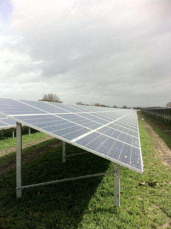
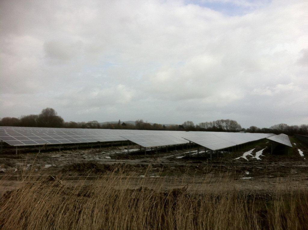
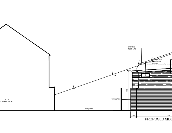
A fire prevention plan sets out the site specific requirements for the storage of wastes in line with the relevant guidance. There are requirements for stack spacing sand fire rescue service access.

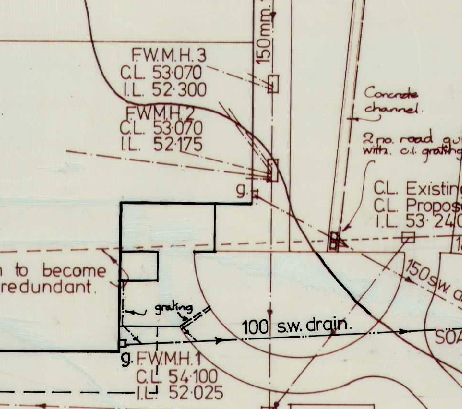
Stack Layouts must be Included

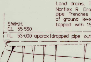
When a fire is extinguished it is often the case that large volume of fire water run off the site and on to surround land, or perhaps in to rivers. The fire prevention plan must set out measures that can be used to prevent this happening.

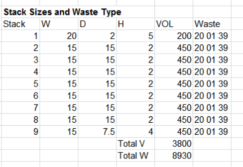
Stack Sizes must not Exceed Max Limits Imposed

These new requirement for fire prevention plans are applied regardless of past performance, and are being requested more and more often during environmental permit applications of any type.

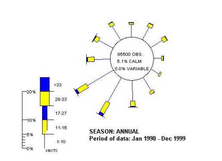
Down Wind Receptors Must be Considered

The content requirement for a fire prevention plan can be considerable, especially during a bespoke permit application. The fire prevention plans produced by SWEL are for environmental protect matters only and do not deal with health and safety of workers or members of the public.

Fire Prevention Plan

Energy Statement – Nailsea, North Somerset

Energy Statement – Nailsea, North Somerset

Acting on instructions from a cobstruction company in North Somerset SWEL are to prepare an energy statement for a high specification home to the south of Bristol.

The residential development consists of a large hill side dwelling with terraces and swimming pool. 

The development is to be built to Code for Sustainable Homes Level 3. This would see emissions reductions required and levels of fabric energy efficiency above those specified in the building regulations.

The above axiometric projections were produced by Zebra Architects Worcester.

SWEL have prepared Sustainability and Energy Statements for projects all over the UK. We have experience in Code for Sustainable Homes up to Level 6, and BREEAM Excellent (including refurbishments).

Sustainability Consultants

Landscape and Visual Impact Assessment – Rickmansworth

Landscape and Visual Impact Assessment – Rickmansworth

It is fairly standard for LVIAs to be requested when large structures are built in a rural setting, but not so in suburban areas. SWEL were interested to see why a LVIA had been requested for a project within the M25 and sited within a developed area.

The residential project was unusual in its scale and design, however the building’s novel form, and inclusion of features such as roof top gardens will make an attractive replacement in contrast to the existing industrial buildings.

Many Sensitive Visual Receptors in the Area

Sympathetically Designed

SWELspent 12 hours walking and cycling though the surrounding landscape to establish points of visibility, whether these were from foot paths, roads of one of the 2 no. SSSI sites in the surrounding area.

There are a great number of hedge rows in the area which contribute visual screening and these will be included in the ZTVs.

A ZTV (Zone of Theoretical Visibility) using computer modelling to deduce where the project will be visible from. Typically these a “bare earth” ZTVs which ignore vegetation and built screening. A ZTV which includes vegetated and built screening is far more time consuming to produce which is why they are often omitted from LVIAs, but a vital part of any LVIA.

Wooded Areas reduce Visibility Impacts

Visual and Landscape Environmental Impact Assessment

Desktop Study – Worcester

Desktop Study – Worcester

SWEL have just completed a desktop study in the Rainbow Hill Area. This report was produced a a quick turnaround. The site in question is being developed for a commercial use which is a lower risk site use. However, teh site is surrounded my numerous contamination sources, a gas works being the most significant.

Gas works were often the site of gasification plants, where coal for heated to produce coal gas, and coke as a bi product. However there are also many harmful bi product produced often which were dumped on to the ground around the plants cause intense contamination.

Benzo-a-pyrene is just one of the many contaminants associated with gasification plants, its causes cancers of teh skin, when people are exposed to it externally, these cancers are likely to form in folds of the skin around the next where dust may collect.

Desktop Study

Surface Water Drainage Strategy – East Devon

Surface Water Drainage Strategy – East Devon

In proving a Surface Water Drainage Strategy to the planning office when submitting a planning application, it makes clear how surface water drainage will be handled within the new development.

Surface water drainage will have to be carefully considered when the project involves large areas of impermeable surfaces.

In this instance an artificial sports pitch surface was to be renewed in and the opportunity was taken to check the adequacy of the surface water drainage on site.

SWEL undertook attenuation calculation in line with the relevant guidance, but were careful to estimate an appropriate attenuation value for the pitch surface.

The current pitch surface would seem to be impermeable but this would not have been the case when the pitch was first installed. By research the subject SWEL were able to determin that the pitch sand (which would be free draining) had becomh contaimanted with fine grained soils (clays etc.) that had reduced its permeability and thus increases run-off potentially.

These characteristics had no doubt developed over the life spane of the exist surface and so to specify draining based on the aged, low permeability surface would have been to over specify.

Instead an average value was used between that of a new surface and that of the surface as was observed.

Legacy Drainage Plan, were used to derive current state of drainage.

Pitch condition reports were used to derive condition of surfaces.

High Quality Legacy Plans helped to facilitate the writing of the report.

Surface Water Management Plan

Geotechnical Investigation & Design for Solar Park – Somerset

Geotechnical Investigation & Design for Solar Park – Somerset

A renewable energy company approached Southwest Environmental as they were concerned that transformer bases incorporated within a new solar park in Somerset were sufficient to meet structural loading.

The solar park which extends to approximately 12 hectares was well under construction with the majority of panels installed, and the transformer bases constructed.

The site was heavily trafficked and access was difficult


most of the solar panels were already installed


lots of solar panels just what the UK needs


again – a large number of solar panels

The site was on the peats and silts of the Somerset levels, these are very challenging areas in which to build, with soils typically exhibiting very low strength values, and owing to the thickness of they superficial silts are infeasible for piled foundations.

Using an established method for the determination of soil strengths SWEL found that the proposed structural loading was very similar to the max allowable loadings for the soil conditions encountered on site. To that end a program of monitoring was suggested for a period of 18 months to span a wet season, and observed for movement, as a secondary option a piled foundation solution was recommended.

The above work was turned around with a 15 day working window, with sampling, dynamic probing, laboratory analysis and reported delivered within a tight time frame.

Geotechnical Somerset

Sustainability Statement – Bristol

Sustainability Statement Bristol

SWEL have recently prepared a sustainability statement for a project in Bristol. The report was wriiten to meet the demands of Bristol City Council, and contained measures to be implemented in order to meet requirements set out in local policy.

As with all our reports, the sustainability statement was written on a quicjk turnaround provided within 10 days of commissioning.

SWEl based our recommendations to suite the clients pre-existing design.

The scheme was a fairly typical residential change of use application.

The sustainability statement was submitted to Bristol City Council well in advance of stipulated deadlines, and the report was well received.

Sustainability Bristol

Sunlight Daylight Assessment – Lambeth, London, SE27

Sunlight Daylight Assessment – Lambeth, London, SE27

The Sunlight Daylight study has been carried out in accordance with  the recommendations of the Building  Research Establishment Report “Site Layout Planning for Daylight & Sunlight 1991”. This is the  standard adopted by a wide range of District and Borough Councils across the UK.

 The scheme was already sympathetically design by the architects in question when plans were forwarded to SWEL for assessment.

Calculations were carried out to assess impacts. The scheme showed at worst VSC and Sunlight at 84% of their former value and as such the reports recommendation as that the scheme was allowed to proceed.

Sunlight and Daylight Assessment Reports London

Flood Risk Assessment Hammersmith and Fulham (W6 9HB)

Flood Risk Assessment Hammersmith and Fulham (W6 9HB)

Acting on instruction received from an architect SWEL have prepared a flood risk assessment for a residential conversion. The scheme was well designed, and the site well placed (interms of level) so as to require the minimum of consideration with regards to resilient design.

High quality modelling data was used to provide a design finished floor level, that was at a very low risk of flooding, the report is being assessed at present with Hammersmith and Fulham Borough Council, and based on our track records SWEL are confident that the report will be well received.

Flood Risk Assessment Reports

Flood Risk Assessment Dartmouth

Flood Risk Assessment Dartmouth 

SWEL were approached by a private land owner in Dartmouth, who had an old garage that they wished to convert to residential use.

A scheme was developed that saw a building designed to be minimally affected in the event of flooding. Ground floor living accommodation was not included in the scheme, instead the living accommodation was included only on the 1st floor.

The 1st floor accommodation was proven to above likely flood depths via the use of detailed flood modelling data, which showed the site to flood to a round depth of 0.6 meters in a very bad flood.

Despite a thorough report concerns were raised over flood safety, the main objections coming from the Environment Agency, and as such they were in a mind to refuse the application.

Despite the flood maps showing a depth of 0.6 meters they do not specify a duration for the flood. However thinking pragmatically this is only likely to last 4 – 6 hours owing to influence of tides, it was this concept put forward by SWEL and presented to district council’s development committee, with a successful out come.

Such was the surprise at the persistent objections from the Environment Agency, that the application had some coverage by the local press.

Flood Risk Assessment Reports